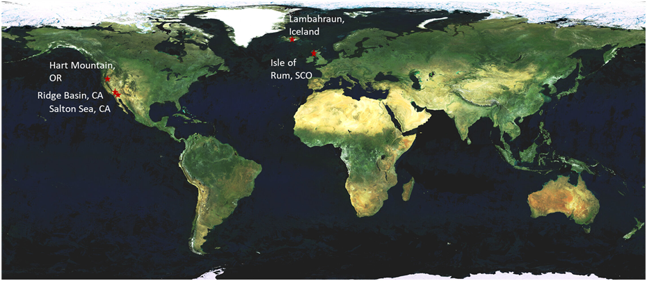
Navigate the sites geology:
Isle of Rum (Scotland) peridotites
The aim of sampling at Isle of Rum was to collect wehrlitic peridotite previously characterized (Hepworth et al., 2018, Hepworth et al., 2020) and proposed to be a suitable analogue for Séitah olivine cumulates, sampled within the tubes Coulettes, Salette, Malay and Robine.
Sampling at Isle of Rum was conducted in July 2023. Field work was led by Lydia Hallis (University of Glasgow, UK) and assisted by Helen Williams (University of Cambridge, UK), Simon Matthews (University of Cambridge, UK), John Bridges (University of Leicester, UK) and Mariek Schmidt (Brock University, Canada).
The field team visited outcrop at Harris Bay and sampled wehrlite belonging to the Transitional Member of Western Intrusion of Rum. The transitional member is a 60 Ma old, ~50 m thick layered peridotite body, and the upper ~5 m of the formation is dominated by wehrlitic peridotite (Hepworth et al., 2018).
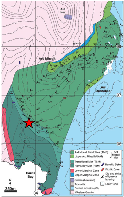
Multiple blocks of wehrlite were present by the side of the road. They looked freshly exposed, perhaps removed from the cliff-forming unit during road construction.
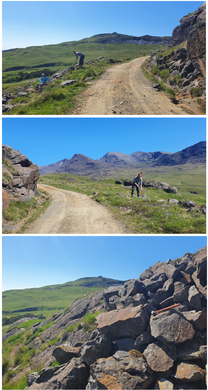
One individual large block was selected and lifted from the outcrop. Subsequently it was broken down with sledgehammers into smaller (portable, i.e. lower than 100 kg in mass) pieces.
Sampling at Rum allowed for accession to MSR ASL of more than 40 individual specimens (labelled as RUM) that range in mass from 97 kg to 400 g. The total mass of samples is more than 280 kg. For details of each sample and associated images, see the Rum Sample Catalogue in the separate document.
At the mesoscopic scale, the hand specimens represent wehrlite, with olivine, clinopyroxene, minor plagioclase as well as chromium-spinel and sulfides in accessory amount. Olivine is altered to iddingsite, mostly along crystal fractures and boundaries.
The samples have a poikilitic texture with clinopyroxene enclosing olivine. Olivine crystals commonly share grain boundaries. Olivine has a maximum grain size of 3 mm. The distribution and modal content of plagioclase is heterogeneous even within individual samples (6–10% by volume).
Hart Mountain (Oregon) basalts
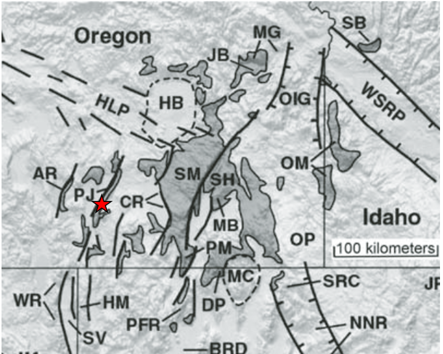
The aim of sampling at Hart Mountain was to collect holocrystalline basaltic lava with plagioclase and augite, proposed to be a suitable analogue for the Máaz augite-bearing basalts, sampled in the tubes Montdenier, Montagnac, Ha'ahoni and Atsa .
Sampling at Hart Mountain was conducted in October 2023. Field work organization was led by Mariek Schmidt (Brock University, Canada), who was not able to attend the sampling itself. The field work team consisted of Nicole Moore (Pomona College, USA), Anita Grunder (Oregon State University, USA), Lori Shiraishi (Jet Propulsion Laboratory, USA), Josh Labrie (Brock University, Canada) and Lynn Robinson.
The field team visited an outcrop at Hart Mountain and sampled basaltic lavas which belong to the greater Upper Steens Mountain formation (Camp et al., 2013). This formation is constituted of 16 Ma old flood basalts associated to the Columbia River Basalt Group. This mid-Miocene magmatic event is linked to the Yellowstone hotspot.
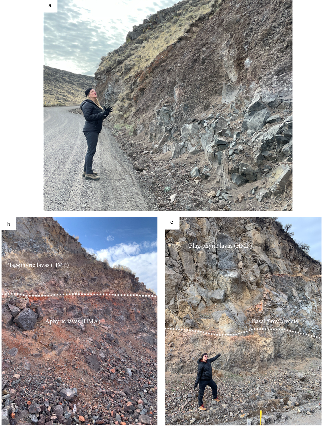
The outcrop is located along a road cut. Two textural types of basalt are exposed in the place: aphyric in the lower part of the outcrop and plagioclase-phyric basalt, overlying the former. The two textural types are separated by a thin red soil weathering horizon.
Samples were collected from talus along the outcrop at the base of road cuts: In lower parts of the hill, aphyric basalt was exposed and pieces were sampled there. Up the hill, plagioclase-phyric basalt was exposed at the base of a road cut, allowing for sampling of phyric material.
Rock hammers were used to fragment and chip away friable material where necessary.
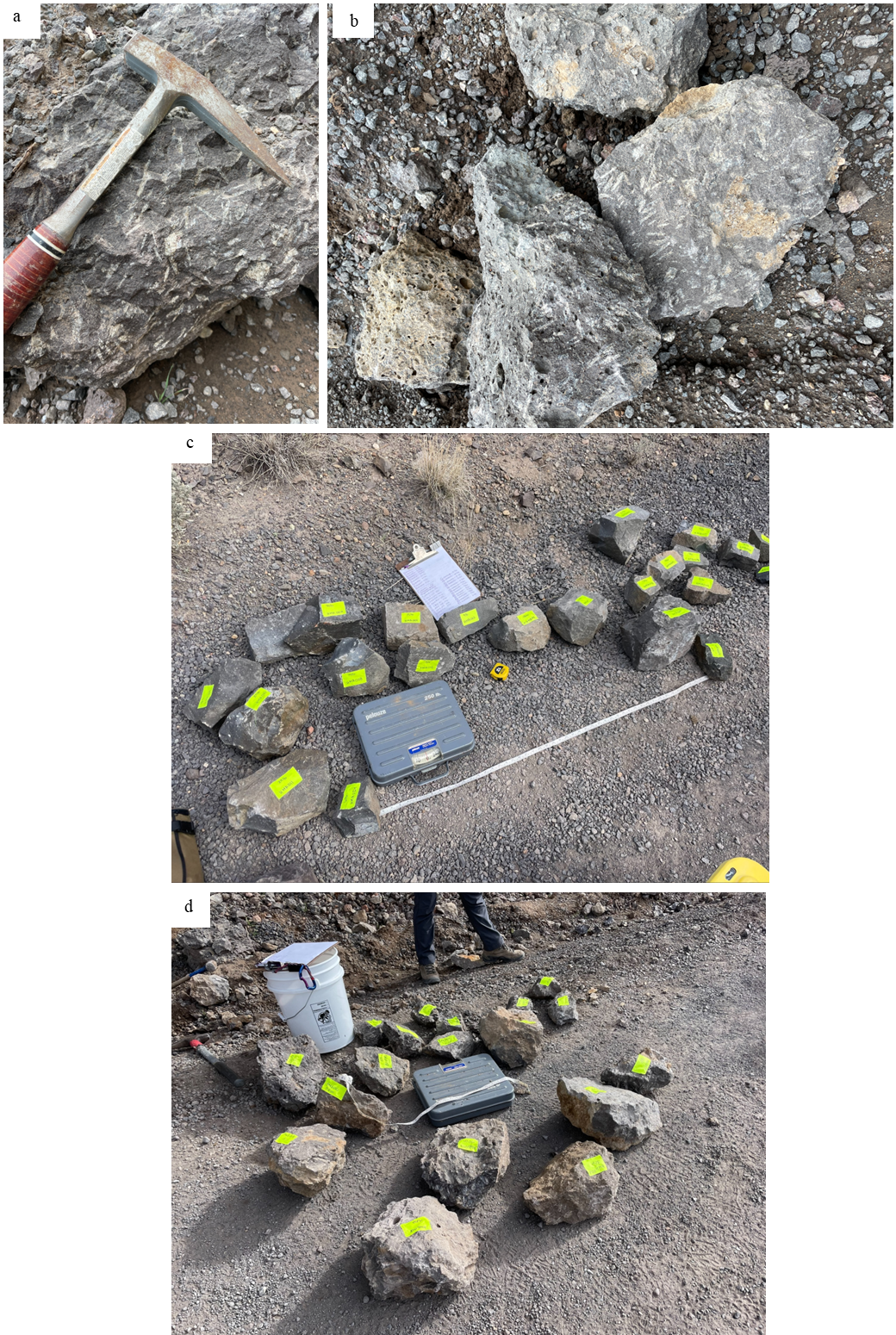
In total, >350 kg of samples was collected at Hart Mountain and provided to MSR ASL. More than 40 individual specimens having aphyric texture (labelled as HMA) are available in the MSR ASL collection and they range in mass from 20 kg to 160 g. In total, the mass of aphyric basalt samples is more than 175 kg. For details on each sample, see the Sample Catalogues for the aphyric samples and for the phyric samples.
At the mesoscopic scale, the hand specimens of aphyric basalts (HMA) appear fine-grained, with the grain size below 1 mm. The rocks are composed of olivine, augitic pyroxene and plagioclase. They contain ilmenite and magnetite in groundmass and as inclusions in feldspar. Olivine is altered to iddingsite.
35 samples having plagioclase-phyric texture (labelled as HMP) are available and those range in mass from 21 kg to 100 g. In total, the mass of plagioclase-phyric basalt samples is more than 170 kg.
The hand specimens of plagioclase-phyritic basalts (HMP) are composed of olivine, augitic pyroxene and plagioclase. They are texturally distinct from HMA specimens in being massive. Additionally, the HMP samples contain olivine with sizes up to 2 mm, enclosed as inclusions in plagioclase and as glomerocrysts. Plagioclase crystals have sizes up to 2 cm.
Sandstones from Ridge Basin (California)
The aim of sampling of Ridge Basin Sandstone was to collect sedimentary material cemented with carbonate, an analogue for the cores Shuyak and Mageik collected at Amalik in the Delta Front of Jezero. Ridge Basin contains well-studied and well-preserved fluvial, deltaic, and lacustrine/marine sediments comprised of clasts of arkoses and lithic arkoses with minor carbonates, deposited in Transverse Ranges of southern California (Crowell, 2003).
Sampling was conducted in May 2023. Field work was led by Kirsten Siebach (Rice University, USA) and assisted by David Beaty (NASA-JPL, USA), Lori Shiraishi (NASA-JPL) and Errin Dalshaug (NASA-JPL).
The field team visited site at Piru Gorge, where multiple authors (Crowel and Link, 1982; Crowell, 2003) reported outcrop of planar-laminated sandstone of Peace Valley formation. This sandstone was targeted and identified from Google Earth photos, followed by field inspection. The greater geological context is a Mid-Late Miocene sedimentary fault bend basin.

The interval chosen for sampling is represented by laminated grey, well-sorted fine sandstone. It is located stratigraphically above fine-grained siltstone and an interval revealing soft sediment deformation. Acid test showed that carbonates are minor in the rock; however, some carbonates appeared to be recrystallizing on surfaces.
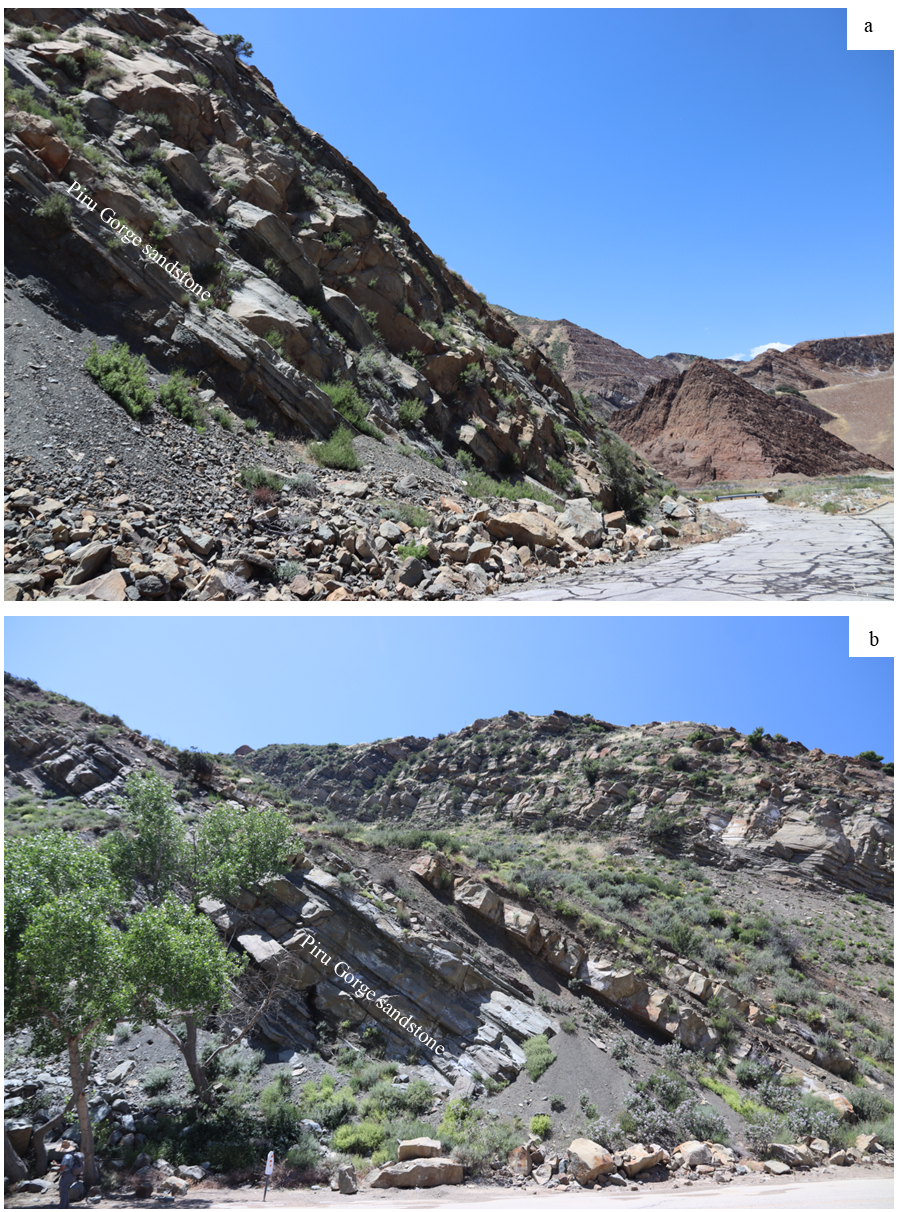
For sampling, float rocks were collected from the ground immediately adjacent to the cliff face that contains the facies of interest. Fragments that showed planar lamination resembling those seen in the outcrop were collected. To avoid weathered surfaces and to produce portable pieces, encountered rocks were broken with hammers.
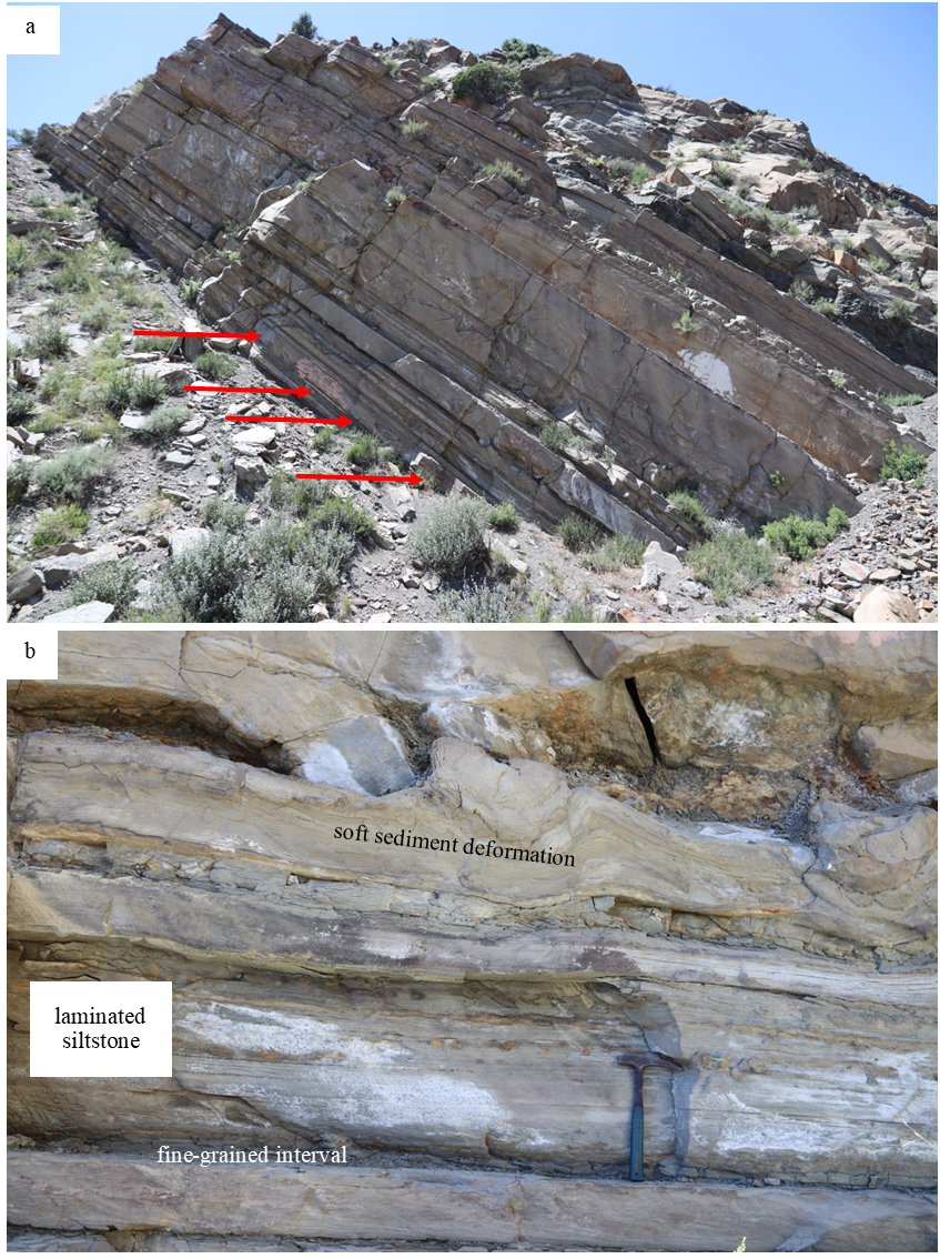
Sampling at Ridge Basin led MSR ASL to the accession of more than 30 individual specimens (labelled as RBS) that range in mass from 30 kg to 100 g. In total, the sampled mass exceeds 120 kg. For details of each individual sample and corresponding images, see the Ridge Basin Sample Catalogue in a separate document.
At the mesoscopic scale, the hand specimens represent sandstone composed of subangular and subrounded clasts of quartz and feldspar. The sandstone is laminated, and darker laminae are rich in biotite and phyllosilicates. Some carbonates are present in intergranular spaces.
Sandstones from Salton Sea (California)
The aim of sampling of Salton Sea Sandstone was to acquire a material cemented with sulphate-carbonate, aimed to be an analogue for the cores Hazeltop, Bearwallow, Skyland and Swift Run, collected at Wildcat Ridge in the Delta Front of Jezero. In this area, carbonate- and gypsum-containing sandstones and mudstones are exposed (Markowski, 2016).
Sampling was conducted in May 2023 on the North Shore of Salton Sea, Durmid Hills. Field work was led by Kirsten Siebach (Rice University, USA) and assisted by David Beaty (NASA-JPL, USA), Lori Shiraishi (NASA-JPL), Errin Dalshaug (NASA-JPL), Maryojo Brounce (UC Riverside, USA) and Jen Humpreys (UC Riverside).
The field team visited the site at Durmid Hills, located adjacent to the southernmost tip of San Andreas fault and to modern (0.76 Ma) Salton Sea. Multiple exposures of gypsum-rich sandstones and mudstones are known from this area (e.g. Kirby et al., 2007; Markowski 2016), and they formed in evaporitic deltaic environment, in episodic arid lakes (Kirby et al., 2007).
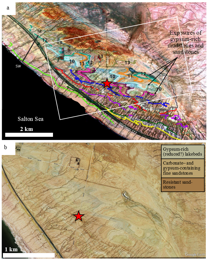
In the area, sandstones and mudstones may contain various content of sulfates. The sampling site was selected among carbonate- and gypsum-containing sandstones, identified from aerial photos by their pinkish color, as opposed to greenish gypsum-dominated mudstones.
Sampling was conducted from a steeply dipping siltstone-sandstone beds exposed in washed beds and gullies close to road. Large portion of rocks in the exposure were too fragile to allow for sampling. The sandstone interval sampled was resistant enough to enable sampling of decimeter-sized blocks.
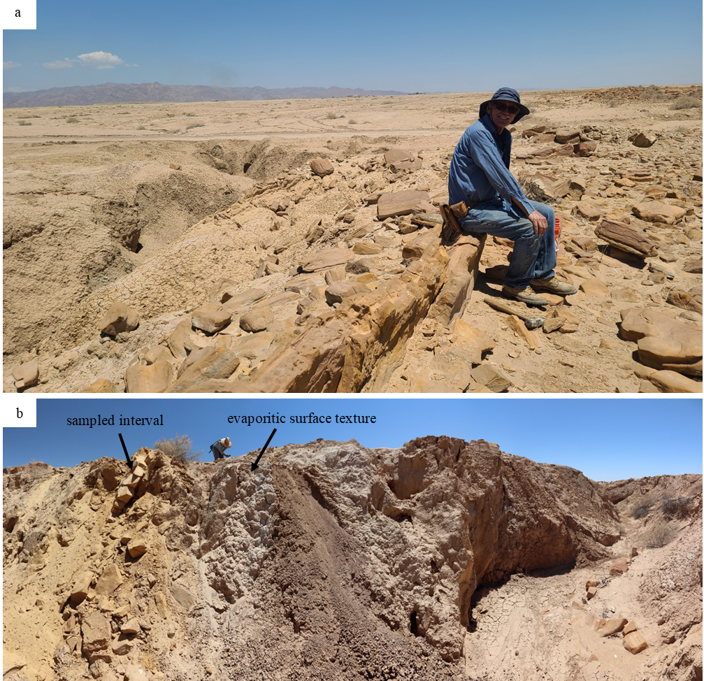
The sampled interval appeared rather homogeneous. It underwent positive acid test, implying presence of carbonates in the cement. The presence of sulfates is inferred from the existence of veins and from the fact that adjacent layers exhibit textures characteristic to evaporitic sulfates. While sampling areas with visible fracture-filling or sparry gypsum were avoided. Samples were separated from the outcrop using rock hammer.
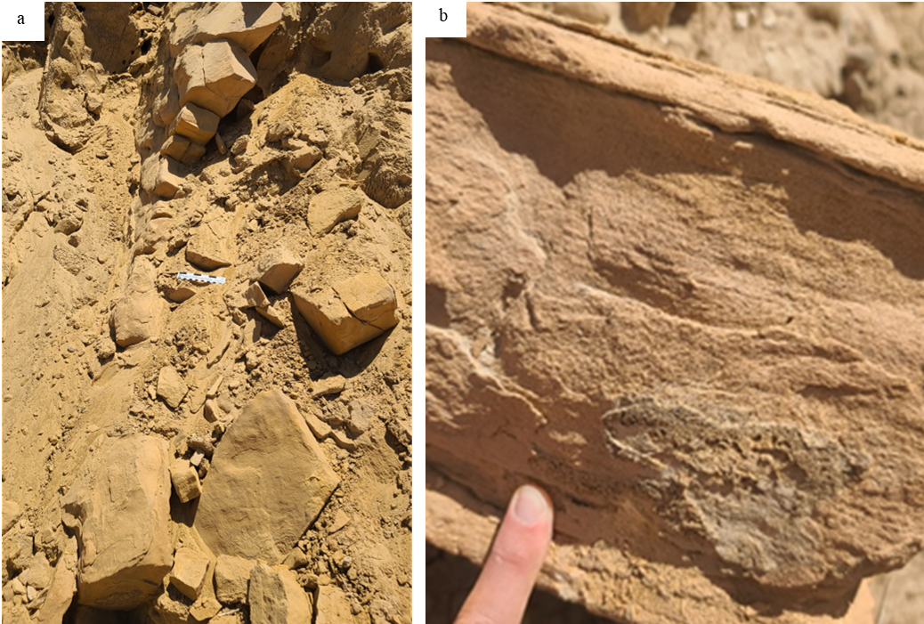
Sampling at Salton Sea led to the accession of more than 30 individual specimens (labelled as SSS) that range in mass from 21 kg to 100 g. In total, the sample mass in the MSR ASL exceeds 100 kg. For details of each sample and corresponding images, see the Sample Catalogue in a separate document.
At the mesoscopic scale, the hand specimens represent well sorted, brittle sandstone composed of subangular-rounded clasts principally composed of quartz. Feldspar and opaque minerals are present too, as well as a significant amount of cement. This cement must be dominated by carbonates; sulphates are likely also present.
Basaltic sand from Lambahraun (Iceland)
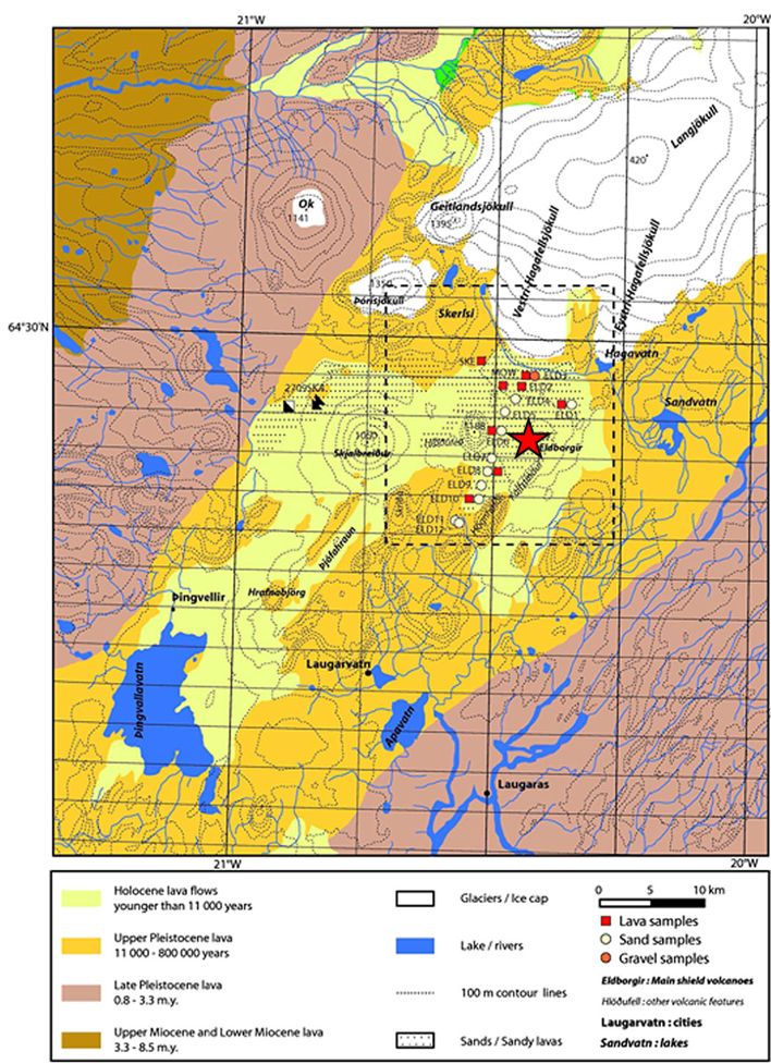
The aim of sampling in Lambahraun was to collect basaltic sand, an analogue for basaltic regolith cached in Delta Front at Hidden Harbor, in the tubes Atmo Mountain and Crosswind Lake. Sand from Lambahraun was previously characterized by Baratoux et al. (2011) and Mangold et al. (2011) and shown to have mineralogical composition and grain size distribution well matching properties of the Perseverance regolith samples.
Sampling at Lambahraun was conducted in June 2023. Field work was led by Elizabeth Rampe (NASA/Johnson Space Centre, USA) and assisted by Michael Thorpe (NASA/Goddard, USA), Ryan Ewing (Texas A&M University, USA), Teresa Fornaro (INAF, Italy), Daniel Leeb (Iceland Space Agency), Gunnar Gudjonsson (Iceland Space Agency) and Fiona Thiessen (European Space Agency).
The field team visited the site at Lambahraun, located in front of Lambahraun volcano and Langjökull glacier. The location was known from earlier studies of Baratoux et al. (2011). The exact sampling point was selected based on field reconnaissance and observation of the sand sheet.
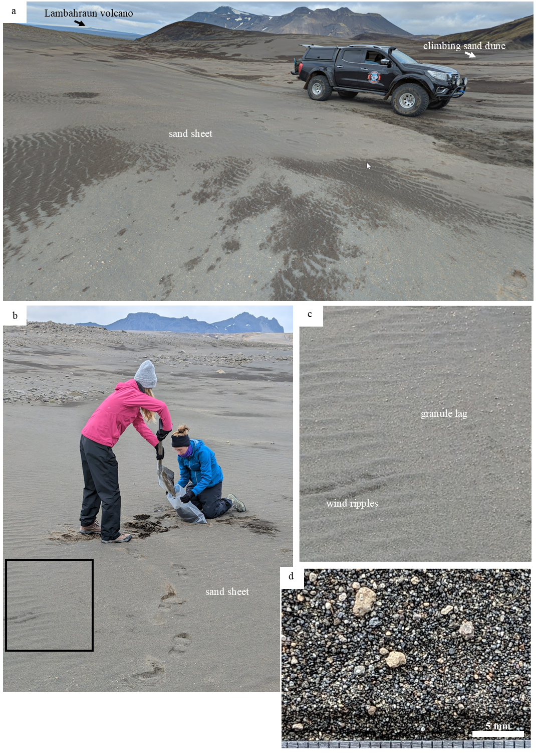
Existing sand sheet and sand dunes were observed by the field team. Sampling was conducted from a sand sheet on the windward side of a climbing sand dune. Granule lag on surface was observed in places, as well as wind ripples.
For sampling, the field site was segmented into a grid with 11 x 2 cells, and ~20 kg of sand was sampled in each cell across the grid. Samples were collected with a shovel from the upper layer (~5 cm depth from the surface), in order to include the coarse lag and sand.
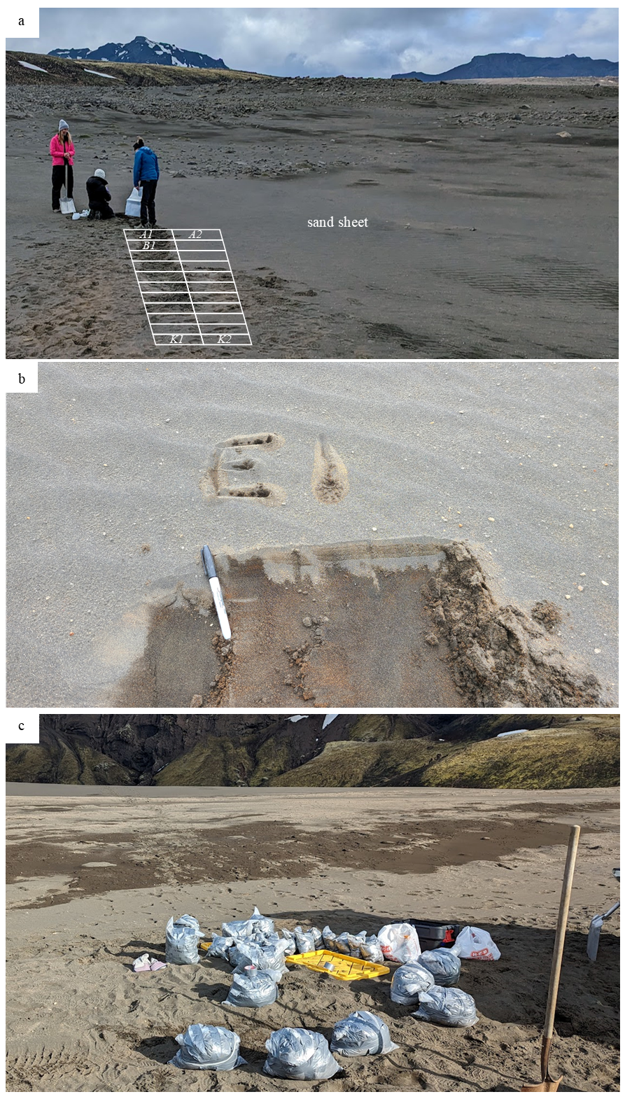
In total, 335 kg of sand was collected from the location and provided to MSR ASL. Information about sample locations within the sampling grid is retained, even though the material across the grid was intended to be uniform. The modal grain size (fine- to medium- grained) is 125 to 350 µm. The sand appears well sorted and well rounded. It is primarily composed of basaltic lithic fragments, mixed with mafic glass and green grains of olivine. Granule lag is coarser grained; grains range from 2 to 4 mm in size. Among larger grains, volcanic pumice is present. More pictures of the Lambahraun sample can be found on the main Lambahraun page.
Hreppar Formation Mafic Sediments (Iceland)
Sampling in Hreppar Formation was undertaken in order to obtain sediments with an expected composition similar to that of the Martian Jezero Fan Front sediments. Therefore, the field team aimed for sediments derived from basaltic lavas in Iceland. The particular location was chosen based on a thesis describing the formation (Dietz, 2018).
The rocks were sampled in June 2025 by a team lead by Michael Thorpe (University of Maryland, NASA GSFC) and composed of Elizabeth Rampe (NASA JSC), Gerhard Kminek (ESA), Fiona Thiessen (ESA), Sandra Siljeström (RISE), Daniel Leeb (Iceland Space Agency), Cherie Achilles (NASA GSFC), Amy McAdam (NASA GSFC) and Alice Baldrige (St. Marys University).
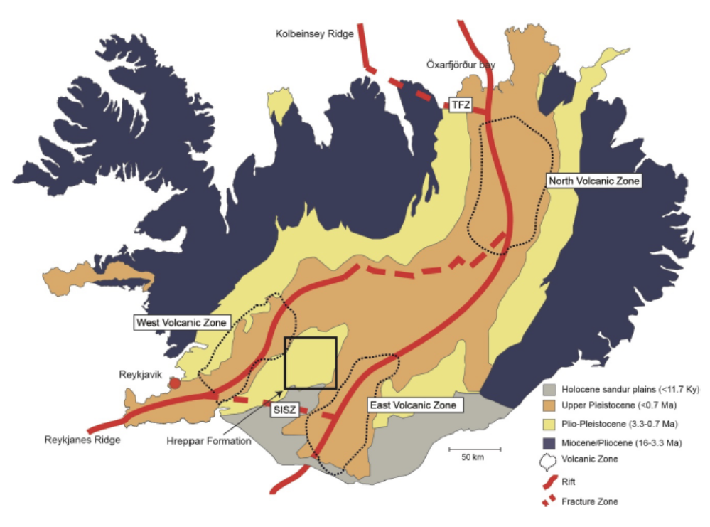
Figure 2.2 from Dietz et al. (2018): Global context of the samples, symbolized by the black square.
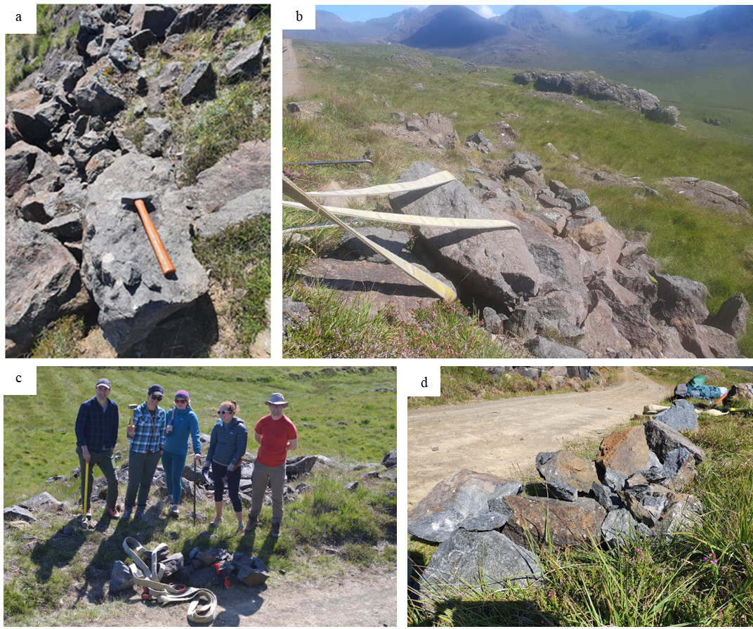
Three different sample lithologies have been recovered in the Hreppar formation, and are thus named in the collection HRF (Hreppar Formation) 01, 02 and 03. HRF 01 is the closest to the original, basaltic lavas, and 02 and 03 are further away, with 03 being the closest to the modern Hvita River.
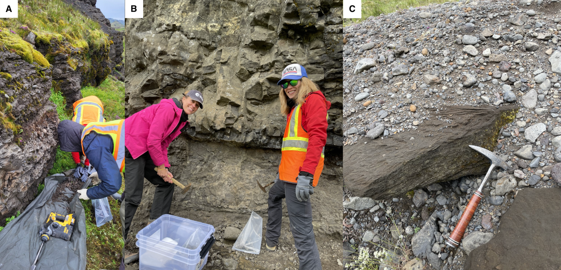
Images of the samples in the field: A = HRF01, B=HRF02 and C=HRF03, with field team and hammers for scale. Credits: field team.
The sediments appear to be a mix of sandstone and siltstones. Existing works proposes that they are derived from a lacustrine environment. HRF-03, contrarily to the two other samples, presents ripple laminations and cross-beddings as can be seen in the figure above. Field mineralogical analyses confirm the presence of plagioclase, pyroxene, smectite and phyllosilicate minerals - backing their soundess as mineralogical analogues for the kind of sediments which can be found on Mars.
References:
- Baratoux et al., 2011: Volcanic sands of Iceland – Diverse origins of aeolian sand deposits revealed at Dyngjusandur and Lambahraun. Earth Surface Processes and Landforms 36: 1789-1808.
- Camp et al., 2013: The Steens Basalt: Earliest lavas of the Columbia River Basalt Group. The Geological Society of America Special Paper 497: 87-116.
- Crowell, 2003: Introduction to geology of Ridge Basin, southern California. Geological Society of America Special Papers 367: 1-15.
- Crowell and Link, 1982: Geologic History of Ridge Basin, Southern California, Pacific Section. Society of Economic Paleontologists and Mineralogists: 1-4.
- Hepworth et al., 2018: Linking In Situ Crystallization and Magma Replenishment via Sill Intrusion in the Rum Western Layered Intrusion, NW Scotland. Journal of Petrology 59: 1605-1642.
- Hepworth et al., 2020: Braided peridotite sills and metasomatism in the Rum Layered Suite, Scotland. Contributions to Mineralogy and Petrology 175:17.
- Itoh, 2013: Mechanism of Sedimentary Basin Formation. Intech Open.
- Kirby et al, 2007: Pleistocene Brawley and Ocotillo formations: Evidence for initial strike-slip deformation along the San Felipe and San Jacinto fault zones, southern California. The Journal of Geology 115: 43-62.
- Markowski, 2016: Confirmation of a New Geometric and Kinematic Model of the San Andreas Fault at its Southern Tip, Durmid Hill, Southern California. MS Thesis. University of Utah.
- Mangold et al., 2011: Segregation of olivine grains in volcanic sands in Iceland and implications for Mars. Earth and Planetary Science Letters 310: 233-243.
- Dietz, 2018: Lithofacies architecture and facies models of volcanic, volcaniclastic and sedimentary rocks in the Hreppar Formation, Iceland: understanding hydrocarbon prospects in volcanic rifted margins. Thesis, University of Glasgow.
Download the complete sampling description in pdf file here (7.34 Mb)