Thesis aim
To reconstruct the geological evolution, structural style, and depositional patterns of the Harstad Basin during the Cretaceous and Cenozoic by interpreting 2D and 3D seismic and well data, and to place this evolution within the regional tectonostratigraphic framework of the southwestern Barents Sea.
Background
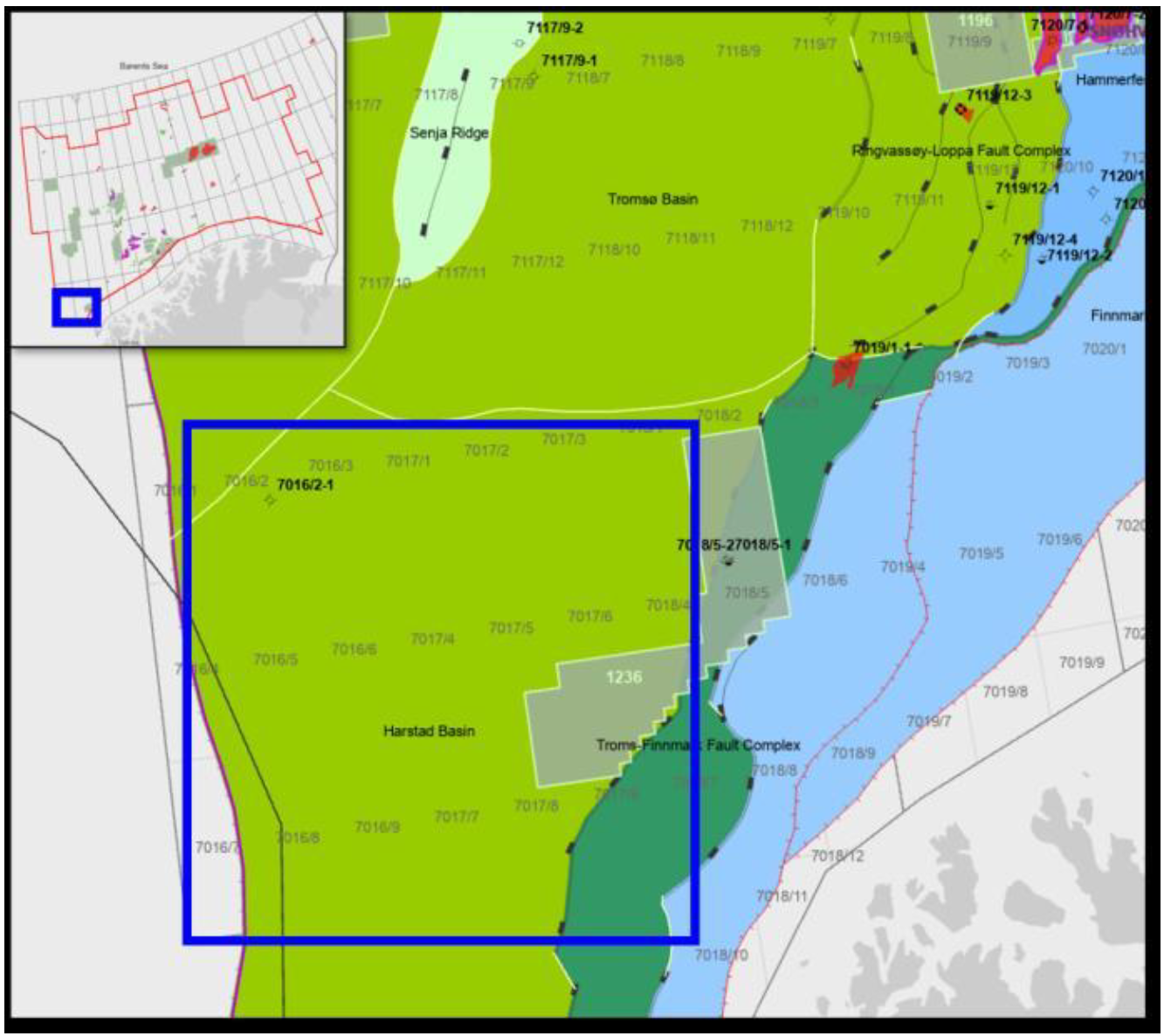
The Harstad Basin is a fault-bounded depocentre in the western part of the southwestern Barents Sea, situated between the Ringvassøy–Loppa Fault Complex to the east, the Troms–Finnmark Fault Complex and Finnmark Platform to the south, and the Tromsø Basin and Senja Ridge to the north. Carboniferous rifting probably initiated the basin, which subsequently underwent major subsidence through the Triassic, Jurassic, and Early Cretaceous, before being capped by a thin, condensed Late Cretaceous–Paleocene succession. Its Cenozoic history—spanning continued basin-margin faulting, regional uplift and erosion of the Barents Shelf, and associated source-to-sink sediment routing—remains poorly constrained, despite the basin’s position along an important rift–shear transfer zone between the Norwegian–Greenland Sea and Barents Sea rift systems.
A substantial dataset of 2D and 3D seismic data and well data now covers the basin and its surrounding fault complexes, offering an opportunity to develop a detailed tectonostratigraphic framework for the Cretaceous–Cenozoic interval, test how rift–shear interaction has controlled basin architecture through time, and re-evaluate the basin’s remaining exploration potential.
Objectives
- Interpret key stratigraphic horizons and structural elements on 2D and 3D seismic data (FP12, Troms III, and selected regional 2D surveys) across the Harstad Basin, calibrated to well data from, for example, wells 7016/2-1, 7018/5-1, 7018/5-2, 7019/1-1, 7117/9-1, and 7117/9-2.
- Analyse the timing and style of faulting, with emphasis on rift–shear interaction associated with the basin’s location between the Ringvassøy–Loppa and Troms–Finnmark fault complexes.
- Characterise sedimentological facies distributions and tectonostratigraphic variation within the Cretaceous and Cenozoic successions using seismic geomorphology and spectral decomposition.
- Synthesise basin architecture and evolution within the established regional plate-tectonic framework, including consideration of source-to-sink systems and provenance of the Cenozoic strata.
- Evaluate potential geological plays in the area, focusing on the Cretaceous and Cenozoic successions.
- Optional: Conduct structural restoration and backstripping focused on the Late Cretaceous–Cenozoic interval
Data and methods
The study will use 3D seismic data (FP12 and Troms III; PSTM and angle stacks) and selected 2D seismic lines from regional surveys (e.g. NBR/AMR, NPD-TR, MCG1301, NH9703, T-85, and TGS-90), together with well-top data from key wells in the area. Publicly available gravity and magnetic anomaly grids may also be used to provide regional context.
The candidate will interpret regional and local horizons in Petrel, primarily in the time domain and, where available, in the depth domain. The work will include amplitude-based depositional mapping and spectral decomposition in Paleoscan to investigate the seismic geomorphology of the Late Cretaceous and Cenozoic sequences in detail. Results will be integrated and displayed in ArcGIS/ArcPro.
An optional component involving structural restoration and backstripping in 2DMove may extend the modelling of the Late Cretaceous–Cenozoic interval.
Learning outcomes
The student will:
- Gain hands-on experience with industry-standard interpretation software, including Petrel, Paleoscan, and ArcGIS/ArcPro, with optional use of 2DMove.
- Learn seismic-stratigraphic and structural interpretation, seismic-to-well tying, and seismic-geomorphology and spectral-decomposition techniques.
- Develop skills in basin analysis, tectonostratigraphic synthesis, and source-to-sink and provenance analysis within a regional plate-tectonic framework.
- Practise independent research planning, project execution according to a structured milestone plan, and academic writing.
Background for project
This thesis draws on an extensive, industry-grade 2D and 3D seismic and well dataset covering the Harstad Basin and adjacent fault complexes. It will contribute to the Department’s ongoing research on the tectonostratigraphic evolution and exploration potential of the southwestern Barents Sea margin.