The Norwegian Continental Shelf (NCS) hosts a suite of geological structures with significant volumes of hydrocarbons. Natural and well-associated seepage of hydrocarbon gas (e.g. potent greenhouse gas methane) from the subsurface accumulations have been documented across the shelf.
In the Norwegian exclusive economic zone around 2,000 wells have been plugged and abandoned, and >2,000 operating wells are headed for decommissioning in the next decades. In this light, there is a growing interest from hydrocarbon exploration industry and research in understanding the origin and magnitude of gas seepage potentially associated with boreholes.
Here we provide a newly acquired multidisciplinary dataset (multibeam echosounder data, water column geochemical data and 3D seismic data) from the North Sea and Norwegian Seas that documents both, natural and well-associated seepage from the seafloor into the ocean (Figure).
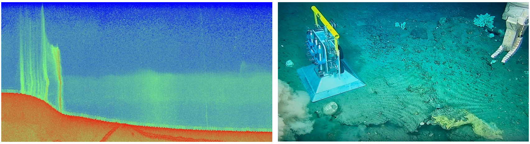
The North Sea and the Norwegian Sea are the richest hydrocarbon provinces on the NCS. In the framework of the WELLFATE project and in collaboration with the Norwegian Offshore Directorate a large set of multidisciplinary data has been gathered from several of the studied locations to study the presence of methane emissions from the seafloor.
3D seismic data will be used to investigate hydrocarbon distribution and migration below the seafloor. Recently acquired flux measurements using a Remote Operating Vehicle allowed to quantify methane emissions at seepage sites (Figure). These benchmarks will be used to scale up the methane emissions in the regions surveyed by multibeam echosounder.
Analysing this multidisciplinary data set will unravel whether the observed gas seeps originate directly from the reservoirs, shallow gas accumulations or potentially gas hydrates, and how much hydrocarbon gas releases in the ocean water and potentially in the atmosphere. Strong gas flares that reach the water surface may allow methane to escape directly into the atmosphere, contributing to carbon emissions. Additionally, high methane concentrations in the water column contribute to ocean acidification.
The outcomes of this project will also contribute to make accurate predictions of environmental impacts and fine-tune future monitoring and mitigation strategies. This study is also particularly relevant since numerous decommissioned wells on the NCS are meant to be repurposed for Carbon Capture and Storage in depleted reservoirs.
Understanding the distribution and drivers of this seepage occurring at or in the vicinity of wells is crucial for evaluating environmental risks, particularly in light of expanding offshore activities such as Carbon Capture and Storage (CCS) and renewable energy developments.
The project aims to address following research questions:
- How many wells are associated with seepage?
- What are the fluids origin and pathways?
- What is the magnitude of methane emissions?
- How much methane reaches the sea surface?
What you will learn:
- Processing and interpretation of multibeam echosounder data to map the seafloor bathymetry and water column to identify gas seepage sites in FMMidwater, Qimira and Fledermaus software
- Interpretation of 3D seismic data using Petrel software
- Analytical techniques and interpretation of water column and geochemical data