Finse is an established research site that has been used in many studies about snow, land-atmosphere interaction, permafrost, biology/ecology, and more. The department of Geosciences at UiO hosts the Finse research station and has a long history of snow measurements – manual snow depth measurements/transects, GPR or drone measurements (repeated in the same area, the “grid”), satellite remote sensing, and a range of other types of snow-related measurements. Finse also hosts a meteorological station with a flux tower that provides measurements of many variables related to land-atmosphere interactions with support from the LATICE research group.
Especially two snow time series datasets from Finse have not been fully analysed and put in a greater context, and are suitable for one or several MSc theses:
- Annual snow depth maps in “the grid”, a 1 km2 area south of the research station. These include high-resolution drone surface maps (since ca. 2014) and dense GPR maps for earlier years, and show how snow depth and distribution vary from year to year.
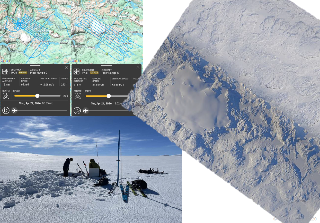
- Melt season time series of >50 high-resolution snow depth maps from spring 2026 for an area next to the research station. This dataset documents in detail how and where the snow sagged and melted in the mapped area.
These data are complemented by a large laser scan dataset acquired in spring 2026, and a number of other snow-related measurements and datasets (see below).
Research questions for a thesis could be, for example:
- How, where and when is the snow melting during spring 2026? What local and topographic properties are contributing? Can the melt season be reproduced with a snow model? Is the analysed site representative for the entire valley?
- How much do the snow depth patterns in the Finse 1x1 km grid repeat from year to year? Is there consistency, are there trends? Can they be described by topo-climatic predictors?
- How representative are the existing measurement locations for the greater Finse area? Or across time – including future climate scenarios?
- Are we measuring in the right place – or should other measurement transects/areas be established? And where?
The student can approach these questions with a different background/target research field in mind, e.g. snow studies, hydrology, permafrost or ground/snow/atmosphere interactions, glaciology, ecology, statistics/spatial modelling, etc. The focus and core elements of the theses can be adjusted to the student interests, for example, remote sensing/data processing, spatial statistics/machine learning, or process-based modelling.
Relevance
The topics described above are directly connected to ongoing work of the snow group at the department, a growing group that includes different research projects where snow plays a role. The topics are of interest to many researchers, and are relevant for the EU Synergy grant SnowShifts, a large research project that will be ongoing for several years. MSc students choosing to work with this data are welcome to actively join the snow research group. Depending on the angle the student wishes to take, co-supervisors from different snow-related research topics can be added to the thesis.
The MSc thesis/theses can contribute to strengthen the Finse research site through a better understanding of what data there is, and what it can be used for. We aspire to make the Finse research site more widely used, also by other groups including international networks such as INARCH.
In 2026/2027, the snow research group is collaborating with the artist Emilia Bergmark through a UiO REAL ART stipend. In this collaboration, we are interested to explore how winter landscapes change with climate change, what visible or sensible effects this has, and who is affected. For this, Emilia will spend some time in Finse and with the snow group at UiO.
Field work
Ongoing research projects will have field work in the Finse area in upcoming years that MSc students may help with. Finse is strategically important for the MN faculty, and we want measurements to continue. It would be desirable if the student would contribute to snow depth measurements (transects, drone flights in the “grid”) for upcoming winters, in the same places as before – or also new places that fit the goals of the thesis and/or ongoing projects.
Rough overview of available snow data
for modern time (2012 to last few years):
- a large laser scan dataset acquired in spring 2026 in connection with the SnowShifts project, that includes the entire Finse valley, Hardangerjøkulen, parts of Hallingskarvet og areas towards Rv7. Further lidar scans may be acquired in upcoming winters.
- Drone flights around the “grid” (seven datasets since 2014) and around the Research station (4 datasets since 2017).
- Melt season time series of >50 high-resolution snow depth maps from spring 2026 for an area next to the research station.
- Snow depth by GPR and dGPS transects (around Hansbutnutten and Research station).
Other data (overview, details would need to be clarified)
- Snow pits (temperature, density, grain types)
- Stable isotopes from some campaigns
- Time-lapse lidar and time-lapse photogrammetry
- Data from flux tower (associated with https://doi.org/10.5194/bg-20-2031-2023), including snow drift data, a mobile flux tower in the marsh from some years (Norbert), and two weather stations a bit further away that were measuring for some years
- Discharge at Middalselvi and Finselvi for some years
- Glacier mass balance measurements on Hardangerjøkulen and Middalsbreen for some years
- Climate change trends and responses: https://cdnsciencepub.com/doi/full/10.1139/as-2020-0051
- Sentinel-2 and Landsat 8 stacks of FSCA and NDVI around the Finse flux tower for 2019-2021
- Historical snow data from the railroad construction times (1890s, in Stortinget reports), NSB/Banenor daily/weekly snow depths
- Snow cover transects from the previous research station leader for 1990s and early 2000s (on paper, need to be digitalized)