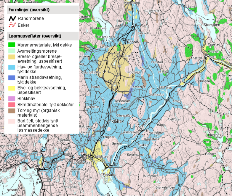
Clay-rich marine sedimentary sequences deposited after the retreat of glaciers after the last ice age are widespread in central east Norway and along the coast (sky blue areas in Fig. 1).
These marine sediments are generally little consolidated but are stabilized by salty pore waters that were incorporated during the marine deposition. Locally, however, groundwaters have over time washed out the salts and deposits have become highly sensitive to differential stresses. The very sensitive clay deposits are termed quick clays, and these may be destabilized by natural processes or human activity leading to devastating quick clay landslides. One recent example is the Gjerdrum landslide that happened without warning on December 30th 2020, and which caused the death of 10 persons and one unborn child.
It is an aim to avoiding any such events in the future. The danger of quick clay landslides are well known and has been known for quite some time, and the requirements for construction sites are strict and also well known. Despite this, events such as the Gjerdrum landslide happened.
One reason for this may be that little is still known about the hydrogeology of quick-clay-prone areas, the depositional control on quick clay formation, and the role of post-depositional deformation in stabilizing sediments. This project aims at investigating marine clays in the Romerike area. Just from geomorphological observations, it appears that the stability of the clays varies geographically. From steep and stable ravines in areas without quick clays to gentle-sloping and unstable ravines in quick-clay prone areas.
Our hypothesis is that this is connected to the depositional environment through the slope of deposition, and syn- or postdepositional deformation of these deposits leads to stabilization.
The project will be the first with an attempt to connect the depositional environment (i.e., the placement of the marine clays in the fjord basin) to quick-clay formation.
The aim of the project is to obtain data that can partly answer the hypothesis that marine clay stability is related to shear deformation and that this in turn varies geographically according to placement in the depositional basin.
Methods that will be used:
- Fieldwork: a sampling of marine clays by shallow coring. Registration of core positions compared to nearby ravines. And recording geomorphology in the area.
- Logging of cores for macroscopic evidence of shear.
- Production of thin sections from selected materials (the student will participate in selecting the materials).
- Microscopic techniques to investigate microstructure, with a specific aim to see whether the «card-house» structure, that leads to the high sensitivity of some marine clays, has been destroyed by shear, or preserved. Same for already collected quick-clay samples from the Gjerdrum area. Instruments that will be used are optical microscopes, and the Scanning Electron Microscope (SEM).
- Grain size distribution of selected samples.