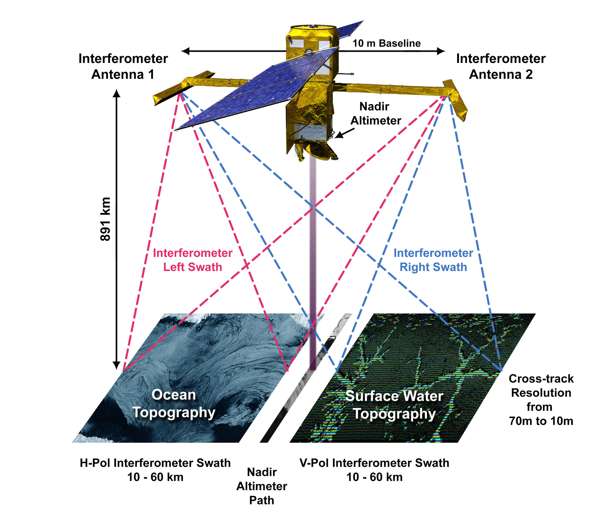
Satellite remote sensing has revolutionised oceanography, and a new altimeter instrument, SWOT (Surface Water and Ocean Topography), has recently transformed our ability to measure sea surface height gradients, from which we can estimate geostrophic surface currents with unprecedented spatial resolution. This instrument improves spatial resolution by a factor of ten compared to earlier satellites and uniquely measures the sea surface in two 50 km swaths on either side of the satellite, as opposed to only along the track directly beneath it (Figure 1).
We are offering two master's projects where students will work with SWOT data in the Northern North Atlantic, specifically off the Norwegian coast:
- Study of Spatial Scales of Mesoscale Ocean Variability in the Northern North Atlantic: The large-scale currents in this region are heavily influenced by bottom topography, following continental slopes and underwater ridge systems. Consequently, mesoscale eddies—akin to atmospheric storms—play a critical role in transporting heat, freshwater, and nutrients between the continental shelves and deep basins, as well as among different deep basins.
The impact of bottom topography on these eddies, particularly their lateral scales, will be a focus of this study. By estimating eddy scales and relating findings to existing theories of topographic influence, we will quantify these scales using spectral methods (such as windowed Fourier or wavelet transforms) or vortex detection algorithms.
The results will be interpreted in the context of established theories regarding topographic effects on hydrodynamic instability and finite-amplitude eddy fields. - Study of Co-Variability Between Ocean Currents and Upwelling of Cold Water Along the Norwegian Coast: Upwelling of cold, nutrient-rich waters over the continental slope is essential for the marine ecosystem along the Norwegian coast. Normally, this region experiences downwelling, particularly in winter when south-westerly winds drive onshore Ekman transport. Upwelling is expected to be episodic and may correlate with anomalies in the Norwegian Atlantic Current (NwAC) and the Norwegian Coastal Current (NCC).
This project aims to investigate whether and how upwelling events, identified as cold sea surface temperature (SST) anomalies (measured by other satellites), are related to anomalies in sea surface height gradients and deduced surface currents derived from SWOT measurements.
The analysis will involve studying the co-variability of SST and surface current anomalies both visually and through objective statistical methods. Additionally, observed co-variability will be correlated with anomalies in regional wind patterns, which may modulate the onshore Ekman transport.
These projects will be conducted in collaboration with the Norwegian Meteorological Institute (MET) and the Planetary Science Institute (PSI) in the United States.