After a few years of discussion and geological investigations, evidence was found and the Ritland structure proven to be the remnants of an old impact crater (Riis et al., in press). The structure is located in Hjelmeland Municipality, Rogaland, Western Norway. It is 2.5 km in diameter, about 350 m deep and was formed probably between 500 and 600 million years ago. The bolide impacted into the sub-Cambrian peneplain where Precambrian gneissic rocks were subaerially exposed at time of impact. The crater was filled by sediments in the Cambrian period and covered by thrust nappes of the Caledonian Orogen in Silurian-Devonian times. Several succeeding events of uplift, erosion, and finally the Pleistocene glaciations, disclosed this well preserved structure with its suevites and well exposed post impact crater-filling breccias, sandstones and shales. The good exposures have allowed a detailed reconstruction of the crater bowl and its infilling history based on geological field mapping.
Outline and Geological background
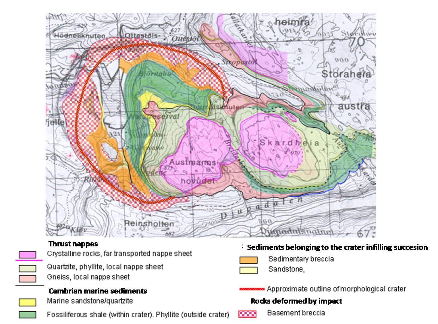
Geological map of the Ritland structure.
Published Dec. 8, 2010 11:35 AM