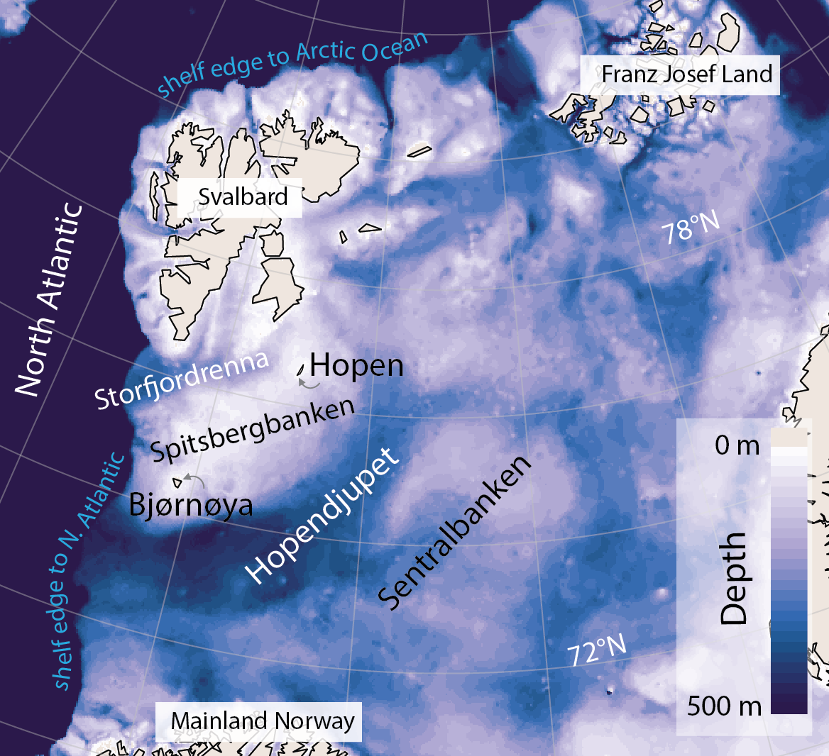
The Barents Sea, one of the widest continental shelves in the world, is host to a treasure trove of geological processes. Rifting, compression, uplift, erosion, sedimentation, volcanism, to name a few. Its polar location hints at another key process, and when looking at the seafloor topography it becomes immediately apparent, major and repeated glaciations have happened here.
In the past 3 million years, there have been around 50 ice-age cycles and as recently as ~17,000 years ago during the Last Glacial Maximum, much of the Barents Sea was covered by a 3 km thick ice. This was part of the Laurentian ice-sheet which also covered Scandinavia and the British Isles.
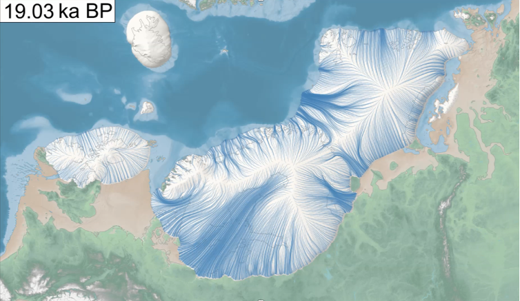
These past glaciation events have left their mark, physically, in the seafloor and sub-surface through thick sedimentary deposits and erosional marks. One of the effects of glacial erosion, along with pre-glacial erosion, is that it has exposed previously buried reservoirs of hydrocarbons. This new configuration can promote flow of hydrocarbons (including methane) from the natural geological traps into the water column, today and in the future. We know this is occurring from previous studies, which include submersible footage of bubble vents, water column and atmospheric flux measurements, and well observations of the sea surface via satellite.
Figure 4. Short footage from a submersible dive showing the seafloor with degassing bubbles of methane (plus a bonus starfish and eel). Courtesy of NPD, we think.
The main aim of this 18-day expedition, “CAGE-22-6-HH,” is to map sites of active fluid flow on the seafloor and understand their geological setting. In turn, the fate of released gases and hydrocarbons, whether in the water column or through to the atmosphere, can be studied and ideally quantified. This is particularly important for the strong greenhouse gas methane, which resides in the deeper layers. The Barents Sea is also an important ancient analogue for the Western Antarctic Shelf where known methane deposits exist and, due to climate change, their release to the atmosphere may have a significant effects on the climate in years to come.
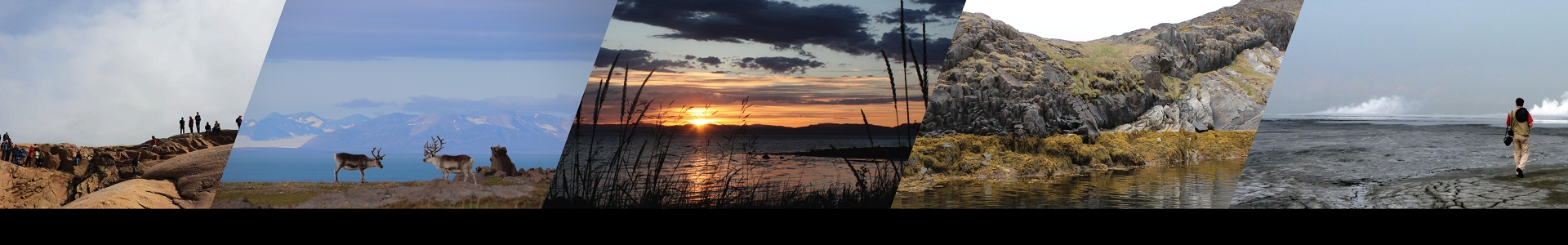
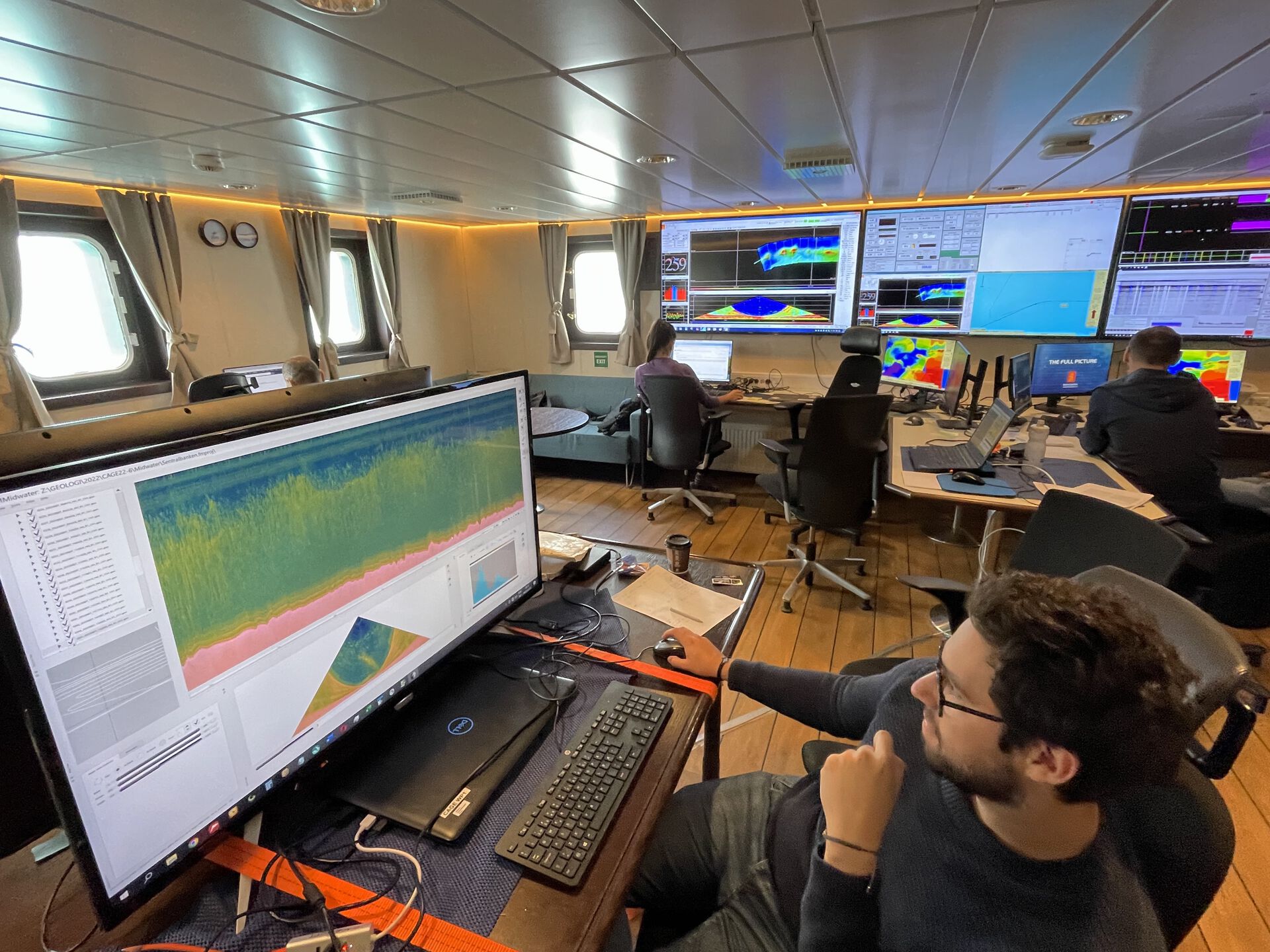
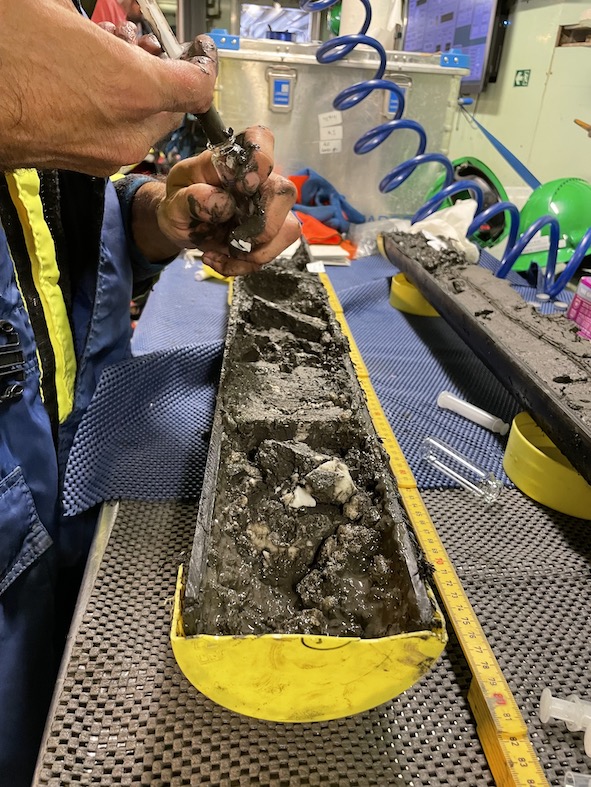
This cruise is also an educational exercise, with students from Bologna University, Kiel University, UiT, and UiO onboard. The cruise is part of both a UiT and UiO course, as well as a UNESCO Teaching-Through-Research course (TTR-22; formerly “The Floating University”). There is therefore a heavy hands-on and two-way educational component between the students and senior scientists onboard. Datasets we are acquiring include multibeam, 2-D seismic (briefly 3-D seismic), CTD and water column sampling, air and sediment sampling (gravity and multi-core), as well as oil slick monitoring and sampling.
In total, we are a scientific party of 13 people, plus two instrument engineers, and the ship’s crew. Of the 13, there are 10 different nationalities onboard (Australia, Brazil, Britain, Columbia, Denmark, Italy, Germany, Norway, Russia). From CEED we are a team of three; Adriano Mazzini, Grace Shephard and Juan Camilo Meza Cala. There are experts on seismology, glaciology, marine geology and geophysics, oil and gas processes, paleontology, mud volcanoes, oceanography, plate tectonics, numerical modelling, seismic hazards, gas hydrates, methane emissions, and more, so there is plenty of science to be exchanged across the 12 hour shifts and regular three mealtimes.
The cruise is coordinated by a ‘sister’ Norwegian Centre of Excellence - The Centre for Arctic Gas Hydrates (CAGE) at the University of Tromsø - which was established in the same funding round as CEED (2013-2023). Our centres have already collaborated a few times before for expeditions, research and education, and it is a pleasure to combine forces once more whilst both centres still exist!
One of the beautiful things about geology is that there are processes occurring across vast temporal scales, from the instantaneous, to annual cycles, to millions of years in the past. This cruise really captures this; we can “see” methane bubbles seeping from the seafloor in real-time, which may be preferentially released in seafloor depressions that have been scoured by ice tens and hundreds of thousands of years ago, which in turn may occur in regions of uplift of erosion over the past millions of years. Furthermore, these escaping hydrocarbons may have travelled along faults in the crust that were formed in the Paleocene, having been earlier trapped in cap rock formed in the Cretaceous, and originally sourced in layers that were laid down in the Jurassic!
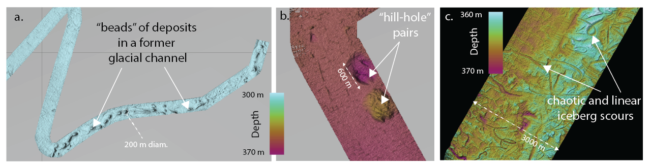
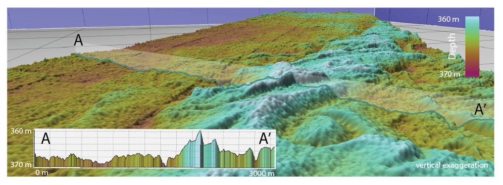
The ship’s multi-beam echosounder instrument maps out the depth to the seafloor (bathymetry), which in turn reveals many bumps and holes of different sizes and shapes. It is quite fun to see these glacial-tectonic features being mapped out for the first time, and in real-time too.
The CAGE-22-6-HH cruise is organized by the CAGE – The Centre for Arctic Gas Hydrates at UiT – the Arctic University of Norway. It has been carried out in cooperation with NPD – the Norwegian Petroleum Directorate, and the INTPART project - HOTMUD. It is also a teaching course at UiT and UiO (5 ECTS), and the UNESCO Teaching-Through-Research (TTR; formerly The Floating University) cruises – cruise number 22. Co-Chief scientists: Henry Patton and Pavel Serov (CAGE, UiT).