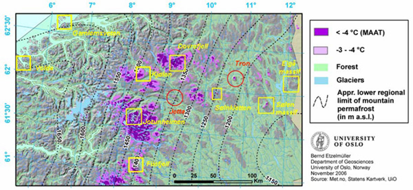
Four boreholes were drilled in bedrock, and bedrock cores were taken. The drillings were carried out by the Norwegian Geological Survey (NGU), who kindly supports this project. The boreholes were cased with 45 mm plastic casing. Seven boreholes were drilled by “Gudbrandsdalen Brønnboring”, Kvam, Norway, using hammer drilling driven by compressed air. These holes are secured with 75 mm casing.
 Borehole 4, Juvvass, 1550 m a.s.l. (Photo: B. Etzelmuller, 2008).
Each borehole is equipped with continuing logging devises, either thermistor strings (M7-system from Geoprecision) or individual MTDs – miniature temperature data loggers (Hobo). The systems monitor temperature normally in a 4 hours interval.
At each borehole site air temperature at c. 1.5-1.8 m height and ground surface temperatures are monitored with a two hour interval. In addition 7 iButton miniloggers were mounted on a pole between 10 cm and 120 cm height and fixed to the system. Those loggers measure temperature every 6 hours to indicate snow depth development. In addition to this installation automatic cameras from Harbotronics monitor snow development at all three main sites, two on Tron, two on Juvvass and one on Jetta. The cameras take one picture every day.
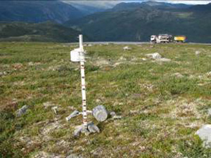 Instrument for measuring snow depth, air and ground surface temperatures (Photo: B. Etzelmuller, 2008).
For further descriptions of boreholes and instrumentations see: