As part of the LATICE project, our team is developing and building a network of instruments able to provide high quality and high resolution data for solving and tracking surface energy balance, CO2 and H2O fluxes in between the land and the atmosphere. Our system consists of two heavily equipped weather stations, one stationary and one mobile, along side a network of light weather stations distributed on land. The formers sample at high frequency the physical conditions of the atmosphere and of the soil, while the latter provide knowledge on the spatial variability of the atmospheric conditions such as temperature, wind, precipitation. Thanks to this innovative installation, we generate a refined picture of the physical processes occuring at the scale of an entire catchement.

The network of instruments is currently in development at Finse, in the surroundings of the Finse Research Station, a selected study site for the LATICE project. The area located at 1200 m above sea level lays in the alpine, bounded South by the Hardangerjøkulen Glacier in the Hardangervidda national park, and North by the Hallingskarvet national park. The region has been historically studied by biologists to study alpine ecosystems, and also by glaciologists and geologists (find many science stories on the Finse Research Station website). With our network we will focus on characterizing exchanges of energy, CO2 and water in between the alpine tundra and the atmosphere across seasons. By adding this network of instrumentation for monitoring physical conditions, we will gain a deep understanding of processes in alpine regions, and produce a dense and rich dataset highly valuable for multidisciplinary approach research.
Flux towers
Stationary flux tower
The stationary flux tower allows for eddy-covariance analysis of the vertical fluxes of heat, CO2 and H2O. It consists of a mast of 10 meter tall equipped with high quality sensors:
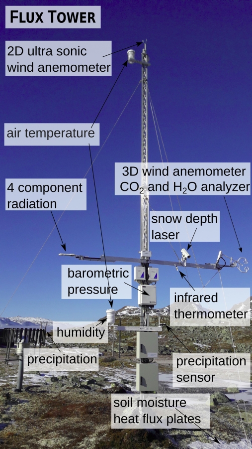
- 2 Wind speed and direction sensors. Sitting at 4.4 meter, the lower sensor provides information of the wind field in 3 dimensions, sampling at high frequency, which allows for characterizing turbulences. At 10 meter above ground, the upper sensor characterizes the wind field in 2 dimensions
- A gas analyzer along side the 3D wind sensor at 4.4m, measuring concentration of H2O and CO2
- Temperatures probes in the soil, in the air at 2 meter and 10 meter
- A soil moisture probe
- 2 soil heat flux plates
- Relative humidity sensor at 2 meter above ground
- A barometer for air pressure at 2 meter above ground
- A radiometer for incoming and outgoing solar radiations at 3.5 meter
- A sensor called Flowcapt to characterize snow drifting events estimate snow drifting fluxes within the lower 2 meter of the weather station
- A precipitation gauge
- A precipitation detector
- A snow depth sensor
Mobile flux tower

In addition to the stationary flux station, we are using a mobile flux station with a similar set of instruments to also characterize vertical fluxes of heat, CO2 and H2O using the eddy-covariance technique. The primary idea is to allow relocation of the station with a minimal logistic, as well as being able to reach remote locations without access to grid power. The station is transportable by car, snow mobile, or helicopter.
It consists of a power trailer providing autonomous power from the sun and wind to the sensors and the datalogger, and an independent tower where all sensors are mounted. Like the stationary flux station, the mobile flux tower includes a high frequency anemometer and gas sampler, a thermometer, a barometer, a radiometer, and a hygrometer.
Wireless Network of Weather stations

For capturing the spatial variability of the atmospheric conditions and to allow a broad sampling of hydrological and cryospheric observations, we installed an innovative and flexible network of data loggers, and communication stations. This system allows for the collection of data over a large area, from either side of the valley of Finse.
This Network is used to record observations of wind speed and directions, air temperatures, snow depth, river discharge, or even controlling time-lapse camera. Because the network achitecture is flexible and resilient, stations specialized for various tasks can later be infilled to increase and widen the set of observation. This is a new approach to collect data, which should prove of high value for validation of models or remote sensing products.
Current conditions at Finse
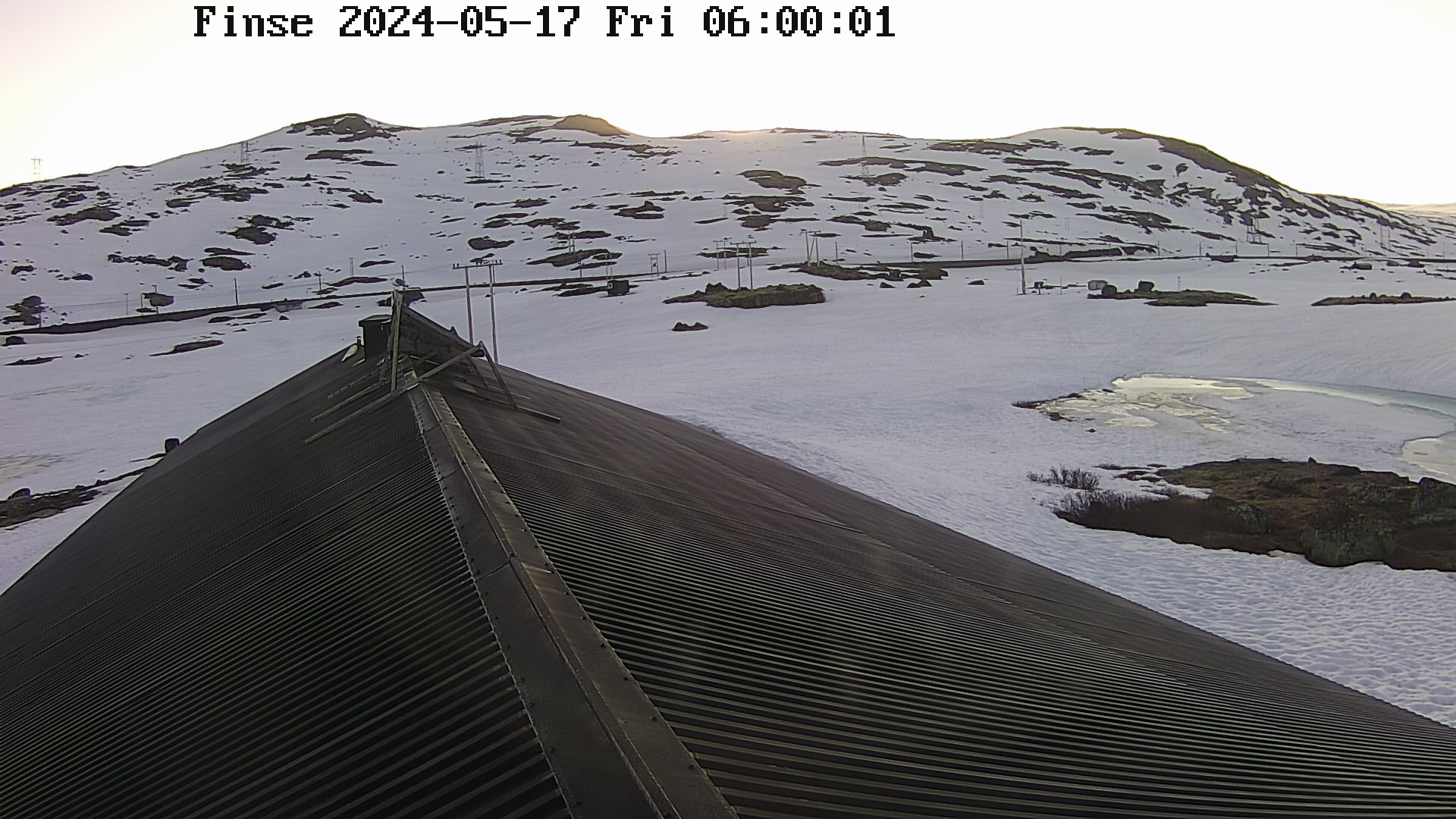
Below is the most recent picture from the Finse Alpine Research Center station at Finse, Hordaland. The flux tower can be seen on the right hand side of the roof of the research station.